No edit summary |
No edit summary |
||
| Line 35: | Line 35: | ||
As its name suggests, this category is a listing of all areas of elevation in Chernarus. They are most ideally used for [[Navigating|orientation]] and getting an overview over the surrounding area. |
As its name suggests, this category is a listing of all areas of elevation in Chernarus. They are most ideally used for [[Navigating|orientation]] and getting an overview over the surrounding area. |
||
| + | * [[Altar]] |
||
| − | {| class="wikitable sortable" |
||
| + | * [[Baranchik]] |
||
| − | ! Name |
||
| + | * [[Bashnya]] |
||
| − | ! Cyrillic |
||
| + | * [[Black Mountain]] |
||
| − | ! data-sort-type="number" | Elevation m |
||
| + | * [[Black Rocks]] |
||
| − | |- |
||
| + | * [[Blunt Rocks]] |
||
| − | | [[Altar]]||Алтарь||471m |
||
| + | * [[Dobryy]] |
||
| − | |- |
||
| + | * [[Dubina]] |
||
| − | | [[Baranchik]]||Баранчик||320m |
||
| + | * [[Green Mountain]] |
||
| − | |- |
||
| + | * [[Grozovye Doly]] |
||
| − | | [[Bashnya]]||Башня||385m |
||
| + | * [[Khrebet]] |
||
| − | |- |
||
| + | * [[Klen]] |
||
| − | | [[Black Mountain]]||Черная Гора||??? |
||
| + | * [[Klin]] |
||
| − | |- |
||
| + | * [[Kurgan]] |
||
| − | | [[Black Rocks]]||Черные Скалы||??? |
||
| + | * [[Kustryk]] |
||
| − | |- |
||
| + | * [[Lesnoy Khrebet]] |
||
| − | | [[Blunt Rocks]]||Гладкие Камни||??? |
||
| ⚫ | |||
| − | |- |
||
| + | * [[Lysaya Gora]] |
||
| − | | [[Dobryy]]||Добрый||175m |
||
| + | * [[Lysina]] |
||
| − | |- |
||
| + | * [[Malinovka]] |
||
| − | | [[Dubina]]||Дубина||294m |
||
| + | * [[Misty Peak]] |
||
| − | |- |
||
| − | + | * [[Olsha (Mountain)|Olsha]] |
|
| + | * [[Ostry]] |
||
| − | |- |
||
| + | * [[Pik Kozlova]] |
||
| − | | [[Grozovye Doly]]||Грозовые Доли||??? |
||
| + | * [[Pop Ivan]] |
||
| − | |- |
||
| − | + | * [[Pustoy Khrebet]] |
|
| + | * [[Shishka]] |
||
| − | |- |
||
| + | * [[Skalka]] |
||
| − | | [[Klen]]||Kлен||324m |
||
| + | * [[Veresnik]] |
||
| − | |- |
||
| + | * [[Vysoky Kamen]] |
||
| − | | [[Klin]]||Клин||??? |
||
| + | * [[Vysota]] |
||
| − | |- |
||
| + | * [[Windy Mountain]] |
||
| − | | [[Kurgan]]||Курган||296m |
||
| − | |- |
||
| − | | [[Kustryk]]||Кустрик||375m |
||
| − | |- |
||
| − | | [[Lesnoy Khrebet]]||Лесной Хребет||448m |
||
| − | |- |
||
| ⚫ | |||
| − | |- |
||
| − | | [[Lysaya Gora]]||Лысая Гора||??? |
||
| − | |- |
||
| − | | [[Lysina]]||Лысина||??? |
||
| − | |- |
||
| − | | [[Malinovka]]||Малиновка||295m |
||
| − | |- |
||
| − | | [[Misty Peak]]||Мисти Пик||??? |
||
| − | |- |
||
| − | | [[Olsha (Mountain)| Olsha]]||Ольша||211m |
||
| − | |- |
||
| − | | [[Ostry]]||Острый||353m |
||
| − | |- |
||
| − | | [[Pik Kozlova]]||Пик Козлова||226m |
||
| − | |- |
||
| − | | [[Pop Ivan]]||Поп Иван||385m |
||
| − | |- |
||
| − | | [[Pustoy Khrebet]]||Пустой Хребет||349m |
||
| − | |- |
||
| − | | [[Shishka]]||Шишка||??? |
||
| − | |- |
||
| − | | [[Skalka]]||Скалка||??? |
||
| − | |- |
||
| − | | [[Veresnik]]||Вересник||??? |
||
| − | |- |
||
| − | | [[Vysoky Kamen]]||Высокий Камень||344m |
||
| − | |- |
||
| − | | [[Vysota]]||Высота||??? |
||
| − | |- |
||
| − | | [[Windy Mountain]]||Bетреная Гора||311m |
||
| − | |} |
||
== Islands == |
== Islands == |
||
Revision as of 17:55, 23 January 2017
The landscape of Chernarus consists of the coast, forests, fields, hills, lakes, and more -- everything on the map that doesn't count as a key location or town. The map has hundreds of these locations, and many of them hold just as much importance to players as those other well-known locales. Below you will find a list of these locations, broken down by category.
Coast
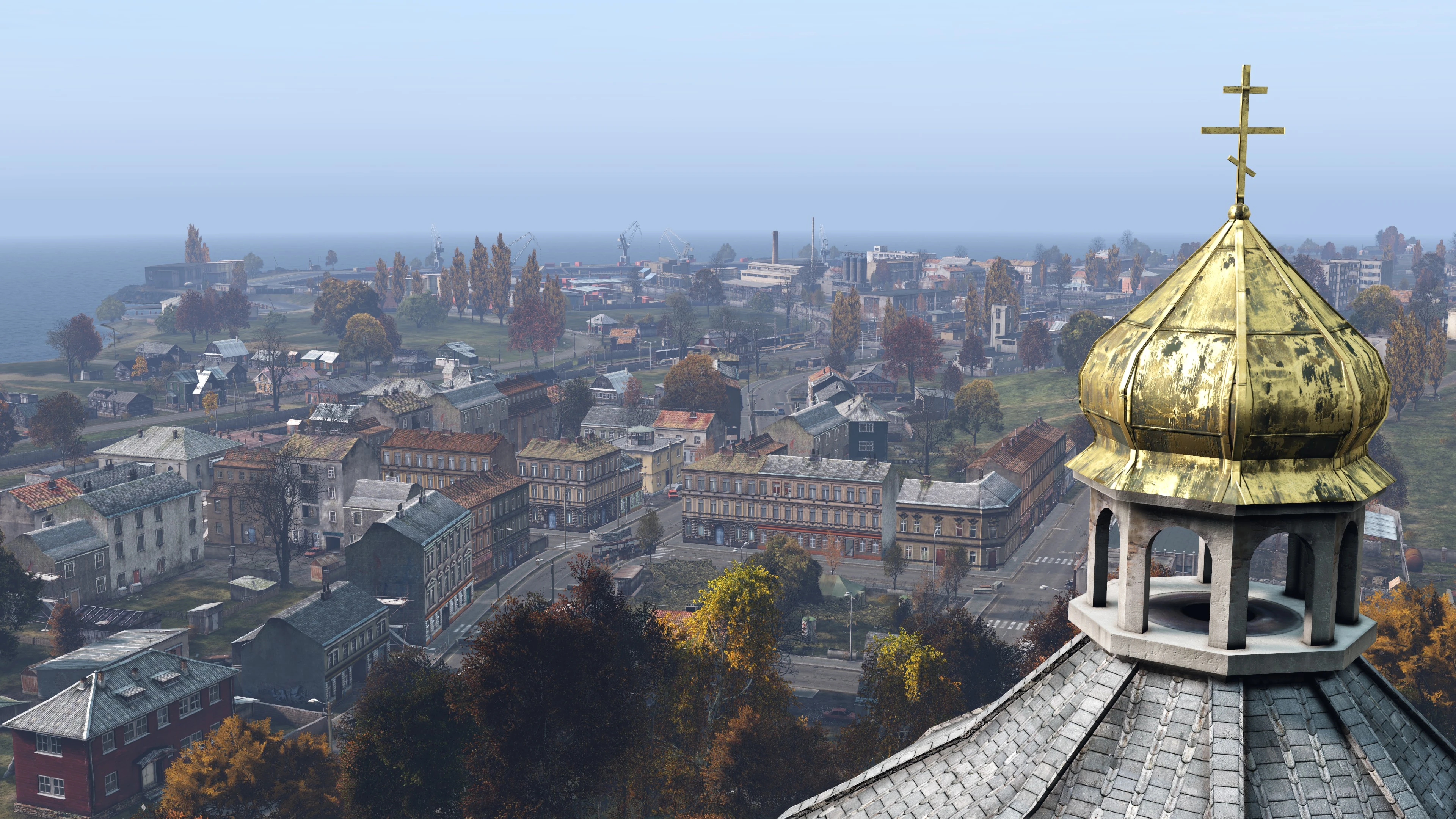
This category consists of bays, peninsulas, and other similar features near to the shores of Chernarus. The coast (or near it) is where players spawn as new characters. It can also be used for orientation or fishing, but cannot be used as a source of water for hydration.
- Bay Mutnaya
- Bay Nizhnaya
- Bay Tikhaya
- Bay Zelenaya
- Cap Golova
- Chyornaya Bay
- Guba
- Krutoy Cap
- Rify
- Skalisty Proliv
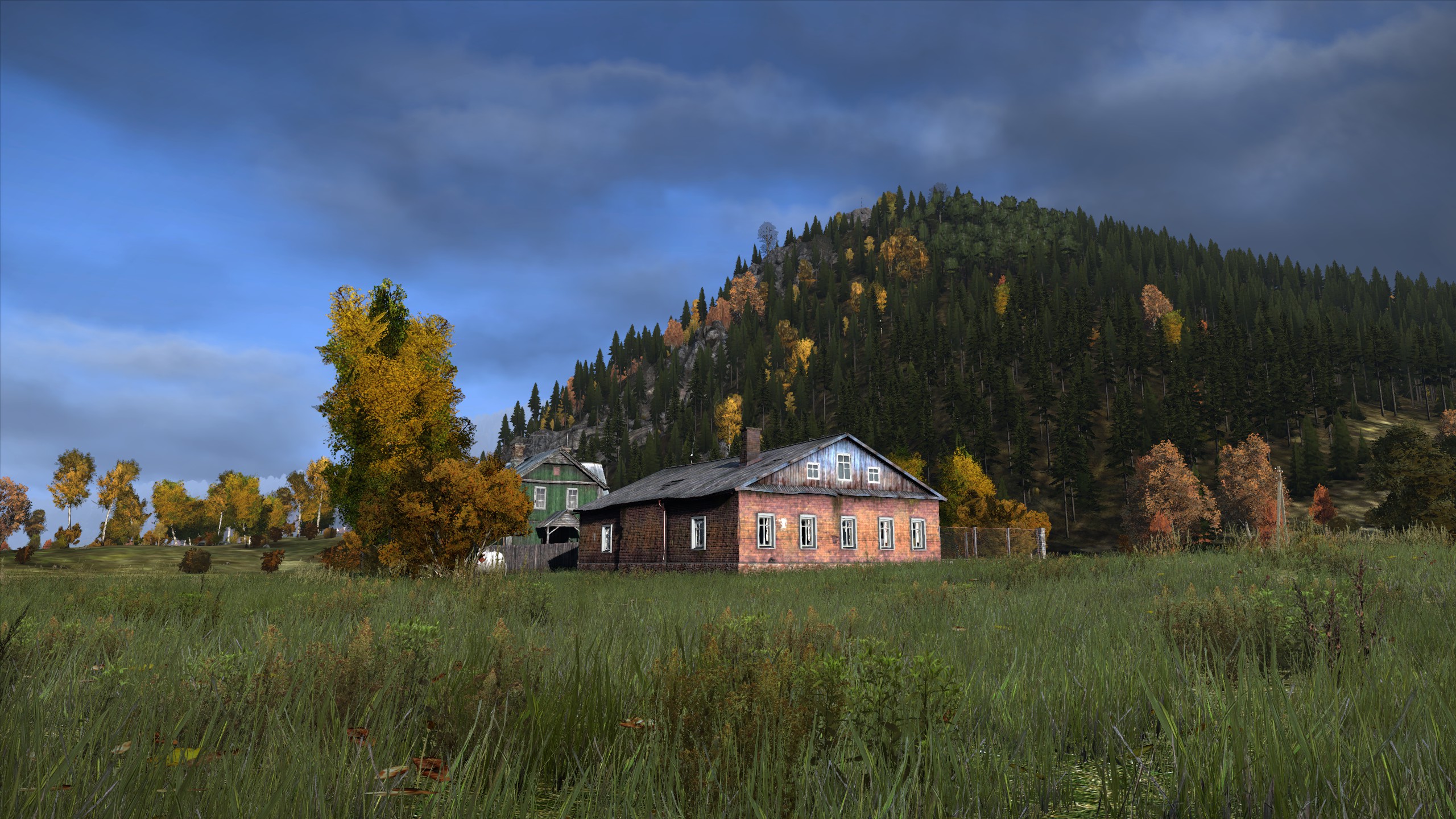
Fields and Forests

Though you'll find fields and forests all across the map, these locations are significant enough to warrant having a name. They are the primary areas for hunting, collecting firewood, and building camps and can therefore be used to avoid other players and to survive on your own without the need for visiting towns.
Hills and Mountains
As its name suggests, this category is a listing of all areas of elevation in Chernarus. They are most ideally used for orientation and getting an overview over the surrounding area.
- Altar
- Baranchik
- Bashnya
- Black Mountain
- Black Rocks
- Blunt Rocks
- Dobryy
- Dubina
- Green Mountain
- Grozovye Doly
- Khrebet
- Klen
- Klin
- Kurgan
- Kustryk
- Lesnoy Khrebet
- Little Hill
- Lysaya Gora
- Lysina
- Malinovka
- Misty Peak
- Olsha
- Ostry
- Pik Kozlova
- Pop Ivan
- Pustoy Khrebet
- Shishka
- Skalka
- Veresnik
- Vysoky Kamen
- Vysota
- Windy Mountain
Islands
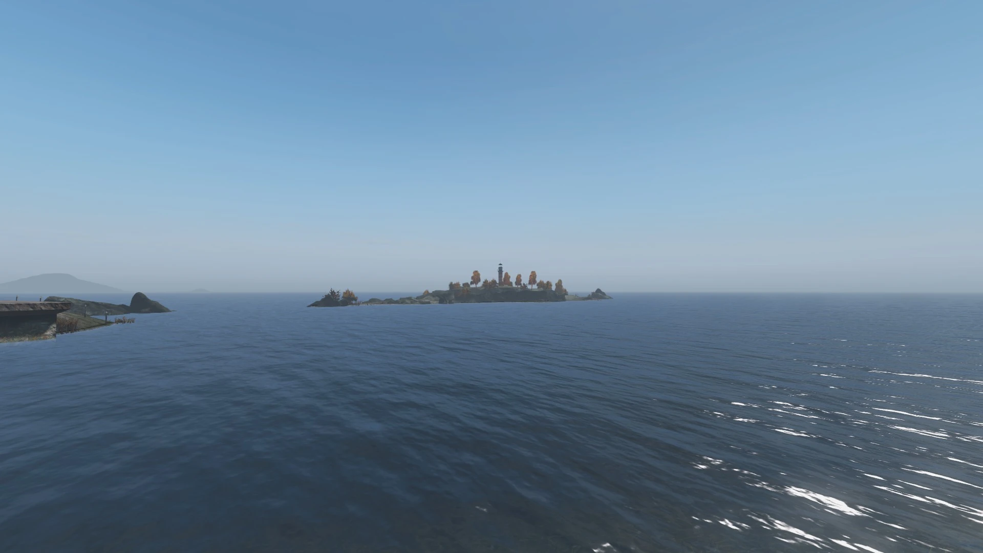
There are already quite a few islands off the coast of Chernarus, ranging from oversized sand bars to entire regions of the map.
Lakes and Ponds
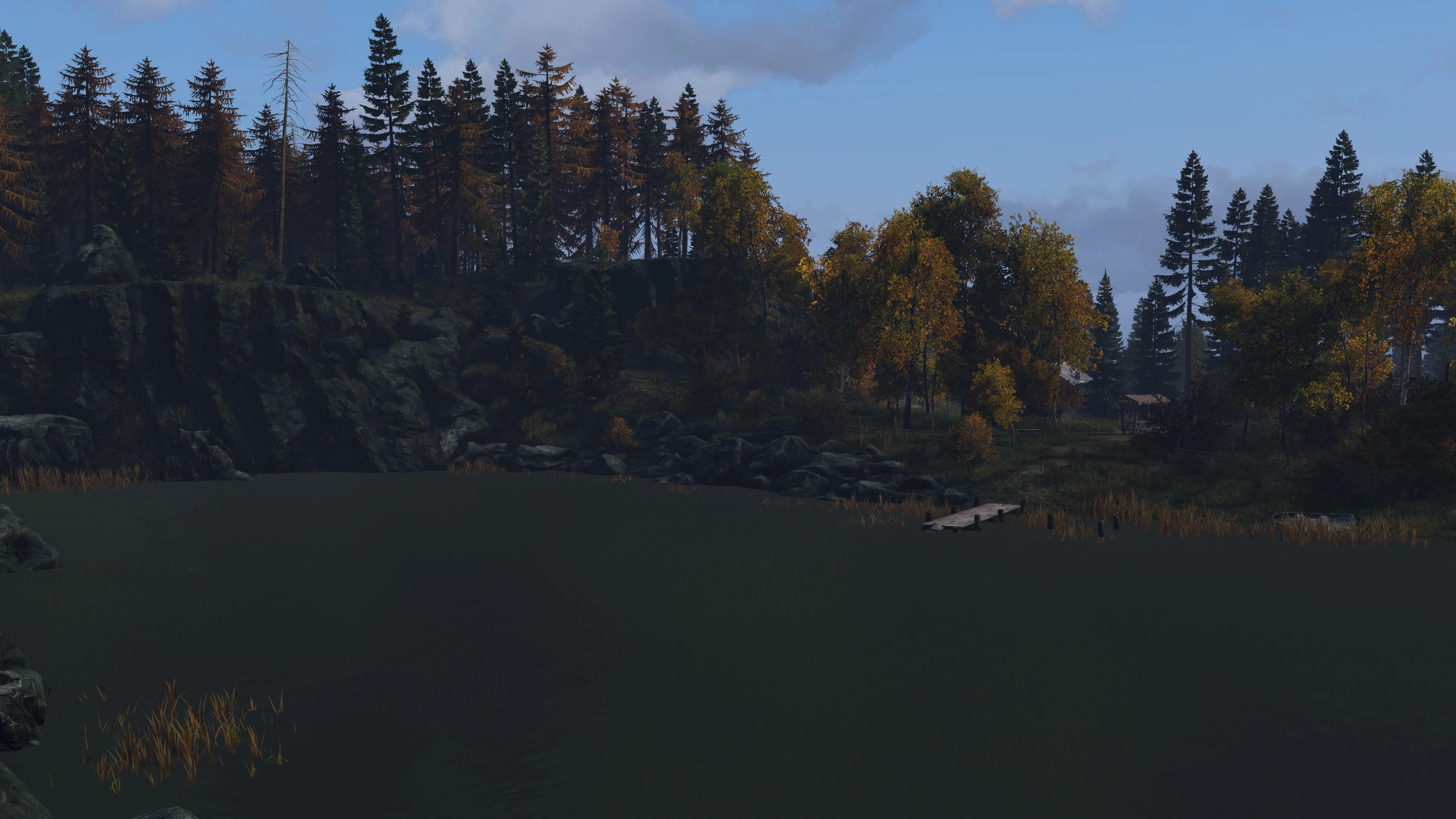
These are smaller bodies of water found throughout the map. They can be used as a source of water, however drinking from a pond or lake carries the risk of infection if not first combined with Water Purification Tablets in a container (such as a Canteen). These locations can also be used to raise your humidity level in order to lower your character's body temperature.
* = Not an officially-named location.